
The Pacific Coast Highway: What the Drive Actually Looks Like Mile by Mile
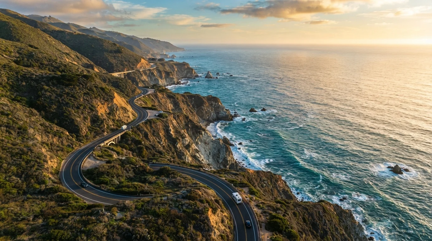
Photo credit: PrimeFaqs.com | Trending And Accurate Content
In this article
A detailed look at what to expect along California's iconic coastal route, from the terrain and towns to timing and road conditions.
The Big Picture: Route, Direction, and Distance
The Pacific Coast Highway - officially California State Route 1, often called PCH - runs roughly 655 miles along California's coastline. Most drivers experience it as a multi-day road trip between Los Angeles and San Francisco, covering the core stretch from Santa Monica in the south to Leggett in the far north, where SR-1 merges into US-101.
Direction matters more than most travelers expect. Driving northbound (LA to SF) puts you in the inland lane, which means the ocean is on your left - harder to pull over and enjoy. Driving southbound (SF to LA) puts you in the ocean-side lane, making spontaneous stops far easier. Most seasoned road-trippers recommend southbound for this reason alone.
The drive is commonly split into three days, though two aggressive days are possible. Budget extra time - this is not a highway for cruise control. If you want to understand how sustained focus on a long coastal route compares to urban or freeway driving, see our guide to highway vs. city driving for what to expect mentally and physically.
Segment by Segment: What You'll Actually See
Santa Monica to Malibu (~30 miles)
The route opens on flat, urban coastline. Beach communities are dense, traffic is heavy, and the Pacific is visible but often separated from the road by parking lots and bike paths. Don't judge the whole trip by this stretch.
Malibu to San Luis Obispo (~190 miles)
After Point Mugu, the road begins to narrow and the terrain opens dramatically. Ventura and Santa Barbara offer mission-style architecture and harbor towns worth a lunch stop. Between Gaviota and Morro Bay, the highway dips inland briefly through rolling oak hills before returning to the coast at Morro Rock - one of the most photographed landmarks on the route.
Big Sur (~90 miles)
This is the stretch most people picture: sheer cliffs, redwood canyons meeting the surf, and roadside vista points with jaw-dropping drops to the water below. Bixby Creek Bridge appears about 13 miles south of Carmel and is the most iconic single structure on the route. Expect slower speeds, limited cell service, and almost no gas stations. Fill your tank before entering from either end.
Big Sur Closure Alert: Always Check Before You Go
Highway 1 through Big Sur is prone to landslides and weather-related closures that can shut the route entirely - sometimes for months. Before your trip, check the Caltrans QuickMap or the official California roads website for current status. Do not assume the road is open based on prior trip reports or travel blog posts, which can be out of date.
Carmel to San Francisco (~120 miles)
The landscape softens here. Carmel-by-the-Sea and Monterey offer quality dining and the famous aquarium. Through Santa Cruz, the highway rejoins heavier suburban traffic. The final approach into the Bay Area via Half Moon Bay features low coastal bluffs and farm stands.
Timing, Road Conditions, and Practical Realities
Big Sur's Highway 1 has a history of closures from landslides and storm damage - always verify current road status with Caltrans before you travel. Conditions can change seasonally or after major weather events. Fog is common year-round, especially mornings in summer, and can reduce visibility significantly on cliff-edge sections.
Late spring (May-June) and early fall (September-October) tend to offer a balance of manageable crowds and stable weather. Peak summer brings heavy RV and tourist traffic, especially through Big Sur, which can turn a 90-mile stretch into a 4-hour crawl.
SR-1 (State Route 1)
The official designation for the Pacific Coast Highway in California. It runs along the state's coastline and is maintained by the California Department of Transportation (Caltrans).
Vista Point
A designated roadside pullout - usually paved and marked - where drivers can safely stop and take in the view. PCH has dozens, especially through Big Sur.
Caltrans
The California Department of Transportation, responsible for maintaining and reporting on road closures, conditions, and construction along SR-1 and all California state highways.
Marine Layer
A low-lying coastal fog common to California's Pacific coast, especially in summer mornings, which can reduce visibility and create cool, overcast conditions even in warm months.
For accommodations, book far ahead for any lodging between Carmel and Lucia in Big Sur - options are limited and they fill months in advance during peak season. Cell service is spotty through long stretches, so download offline maps before departing.
Gas up at every opportunity south of Carmel and north of San Simeon. There are stretches of 60+ miles with zero services. Cash is useful at some smaller roadside stops. Check the official Caltrans website and your state's travel advisories before departure, and verify any entry or access requirements for state parks along the route.

Author
Travel & Trips Editorial Team
Travel & Trips Editorial Team is the collective byline for our editorial team and contributor network. Articles published under this byline or an editorial pen name are researched, written, and reviewed according to our editorial standards for clarity, consistency, and independence before publication.
View all articles →